Perseverance Atlas – The Equatorial Belt - Part I
“No one builds a home in the Belt because it’s safe. They build it because it’s the only place no one else wanted – and they made it theirs.”
– Eliza Kane, Commonwealth Ranger
The Equatorial Belt is the harsh, sun-blasted heart of Perseverance: a place of extreme contrasts, where survival hinges on timing and resilience. Scorching days give way to freezing nights, and the landscape shifts between towering mesas and treacherous dust seas. It’s the industrial and symbolic core of the planet’s frontier identity, brutal and full of buried opportunity.
This is the first of a multi-part journey through the Belt. In this entry, we’ll chart its defining landscapes and the strange places hidden between them, from volatile dust seas and canyon mazes to eerie arches and haunted craters. These aren't just locations. They’re narrative pressure cookers, where every terrain detail is a story hook waiting to ignite.
Major Biomes of the Equatorial Belt
The Equatorial Belt stretches across the heart of Perseverance like a scar, hot and dangerously alive. What looks like barren desert from orbit is, in fact, a complex mosaic of shifting terrain and volatile geology. These biomes are not merely backdrops; they shape every decision settlers make, from what they wear to how they mine and survive.
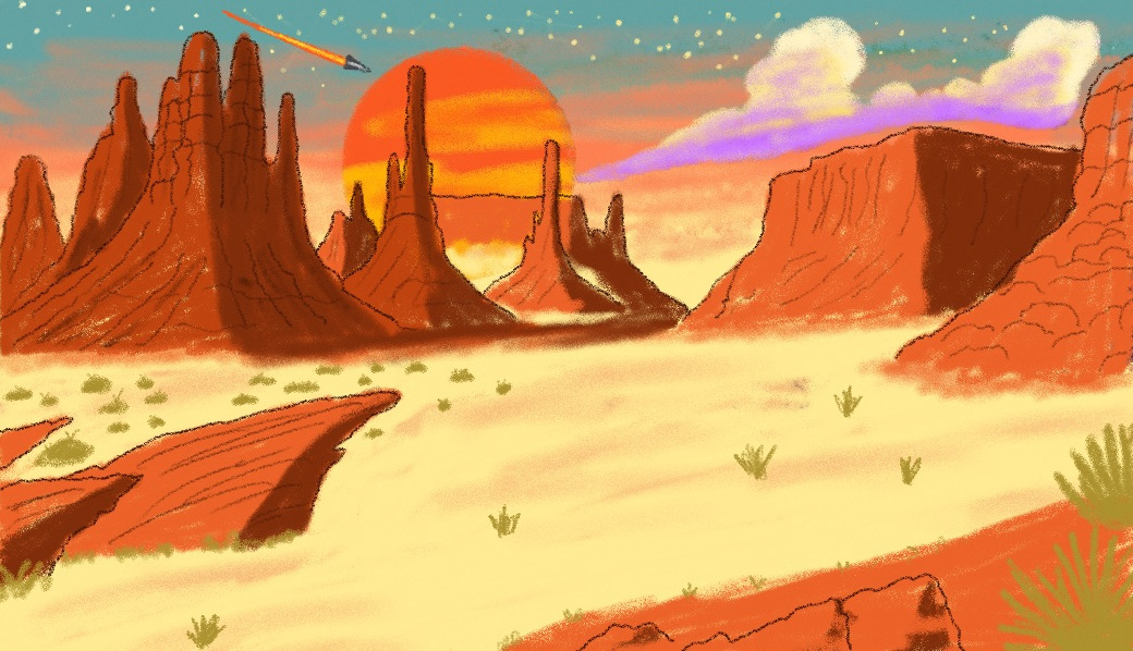
The Red Canyons
A network of deep ravines and dust-choked valleys, the Red Canyons stretch like fractured veins across the southern reaches of the Equatorial Belt. Carved by ancient tectonic shifts and long-dry rivers, the canyons form a natural labyrinth, hostile to mapping and sometimes even memory.
Magnetic interference is common here. Compasses spin uselessly, GPS signals stutter and die. Long-range comms vanish into static. Even experienced skiff pilots mark their routes with tethered flags or simple carved symbols, and even then, many are lost. Locals swear the rock itself moves, shifting walls and passages between storms.
The Canyons are notorious as a haven for outlaws, smugglers, and rogue miners, many of whom vanished from Commonwealth records years ago. Their hideouts are built into the walls, barely visible until you're too close to leave. Old mining rigs, abandoned during corporate pullouts or collapsed expeditions, lie half-swallowed by dust and stone. Some still run on auto-looped routines, harvesting nothing.
Explorers seeking relic tech or untapped veins tread carefully here. So do bounty hunters, hoping to disappear as easily as their targets. The dust isn’t just a hazard; it’s a curtain. Beneath it, anything might be hiding.
“You don’t navigate the Canyons. You survive them. Then you get out before the Canyons notice.”
– Dellen Vass, skiff captain
The Iron Mesa
Rising above the badlands like the fractured rib of a giant beast, Iron Mesa is one of Perseverance’s richest and deadliest mining zones. Its towering cliffs are riddled with open-pit shafts, cable lifts, and rail-thin skimmer docks, etched into rust-red stone striped with ore. The mesa earned its name for the high-density ferromagnetic veins beneath its crust, but that same magnetic instability makes drilling and life dangerously unpredictable.
Quakes are common, as are sudden landslides and equipment failures caused by magnetic interference. The ground hums at times, like a buried engine, and old miners swear they can hear the stone breathe.
Mining syndicates operate with brutal efficiency, sending debtors and desperate locals into the depths under short-term contracts and armed watch. Independent claims exist too, barely legal and often unregistered, protected by hired guns or sheer secrecy.
“You don’t mine Iron Mesa. You raid it, and hope it doesn’t bite back.”
– Mila Cartwright, FML operative
The Salt Flats
To the west of Iron Mesa lie the Salt Flats, a shimmering, deceptive wasteland where heat mirages dance across the horizon and death hides beneath the surface. These vast plains of ancient evaporated seas stretch for hundreds of kilometers, coated in thick, blinding crusts of salt and mineral residue.
By day, the sun bakes the surface to unbearable temperatures. Steel warps, electronics fry. Unprotected skin can blister in minutes. By night, the temperature plummets so rapidly that even seasoned travelers risk frostbite if caught unprepared. The salt itself is jagged and sharp in places, cracking underfoot with hollow groans, a reminder that what looks solid may be nothing but a crust over ancient sinkholes or gas pockets.
Settlements are rare here, clustered tightly around geothermal vents or the precious shade of deep rock formations. Most structures are half-buried or retrofitted from mining rigs and harvest skiffs. Water is more precious than bullets, and fuel is everything.
Independent fuel harvesters operate mostly under moonlight, using modified skiffs fitted with wide pressure pads and thermal shielding to skim across the surface. They draw hydrogen from brine pockets or use old-world condenser rigs to crack vapors from the dry air. Many never return, swallowed by sudden quakes or mechanical failure in a place where rescue is a myth.
“You don’t conquer the Flats. You strike quick, pray your scrubbers hold, and get the hell out before the sun finds you.”
– Harlan Vex, frontier fuel runner
The Dust Sea
The Dust Sea is a vast, shifting basin of ultra-fine particulate dust, so light and dry it behaves more like a fluid than solid ground. The surface flows in slow, unpredictable currents, shaped by deep thermal activity and winds that scour the basin’s edge. The Dust Sea is unnavigable by wheeled vehicles or walkers; anything that disturbs the surface too long sinks and vanishes.
Instead, daring crews operate low-drift skiffs, modified hovercraft with broad pressure plates and stabilizers designed to “float” across the surface without kicking up lethal subsidence waves. Smugglers and ghost prospectors use it as a highway, or a hiding place. Many never return.
The Dust Sea is rich in rare trace elements, buried under strata of mineral drift, and old Commonwealth survey records suggest there are sunken installations or wrecks somewhere near its center, though storms and signal loss make mapping impossible.
“You learn to read the dust like water. The color, the shimmer. You miss the shift? You’re gone.”
– Tayro "Siltwalker" Jin, independent skiff pilot
Glass Plains
The Glass Plains stretch across a once-volcanic desert east of the equatorial belt, where meteor strikes and chemical storms fused vast tracts of sand into mirror – like terrain. During the day, sunlight reflects in lethal arcs; temperatures on the surface can spike high enough to cook exposed electronics or blind careless travelers.
The fused surface cracks underfoot, creating jagged blades of obsidian glass that shift with the heat. Beneath the crust lie mineral veins, pockets of toxic gas, and sometimes relics from the early settlement era: half-sunken skimmers or tech sealed under vitrified dunes.
Crossing the Glass Plains is an act of desperation or hubris. Only specialized heat-shielded vehicles or dusk-time traversal offers hope of survival.
*“It’s not the heat that kills you first. It’s the silence. The way your boots don’t crunch – they whisper.”
– Selene Varn, scavenger guide
Landmarks
Scattered across the vastness of the Equatorial Belt are sites that defy classification: remnants of old empires, strange geological formations, or places wrapped in rumor and silence. These landmarks are not towns or regions. They are flashpoints for stories, mysteries waiting to be triggered.
Echo Caves
Collapsed mine turned subterranean enigma
Beneath the fractured peaks bordering the Red Canyons lies a labyrinth of tunnels known as the Echo Caves. Originally carved during the second mineral rush, the mine was abandoned after a seismic event collapsed the main shaft and killed two dozen workers. Since then, whispers have surrounded the site, both figurative and literal.
Deep within the caves, sound behaves strangely: voices echo back warped or in languages no one recognizes. Some explorers claim the caves rearrange themselves, or that old mining drones still roam, long since disconnected from any control system. Others believe the caves were built on top of something far older than the mines.
“If you hear yourself arguing with you… leave. It ain’t just the rock listening.”
– Vano Lerr, ex-surveyor
The Shattered Arch
Monolith of unknown origin
Rising from the salt crust like the ribs of a giant beast, The Shattered Arch is a fragmented stone loop, partially fused to the desert floor. It stands alone in the Salt Flats. No ruins nearby, no record of construction. Scavengers say it registers as inert ceramic, yet it hums faintly when touched.
Some claim the Arch is a pre-Commonwealth terraforming relic. Others believe it’s not from Perseverance at all. More than one drifter has camped beneath it and reported strange dreams, missing time, or static stored on their gear. The Commonwealth officially denies its existence.
Black Lung Crater
Volcanic sinkhole and toxic ghost zone
Located southeast of Iron Mesa, Black Lung Crater is the site of a failed geothermal experiment. What began as an energy prospecting outpost ended in disaster when a buried gas pocket ignited, collapsing the drill site into a simmering pit of ash and poison.
Today, the crater belches plumes of metallic vapor. Scorched equipment litters the perimeter, some of it still salvageable if you're quick and careful. The crater is now home to feral machines, damaged by the explosion and running corrupted routines. Survivors speak of heat ghosts: flickers of light that mimic human movement.
“Gear’s still down there. Good gear. Problem is, so’s the screaming.”
– Jessa Vorn, scavenger
The Bone Bridge
Natural stone span turned outlaw hangout
Stretching over a wind-carved canyon on the eastern edge of the Belt, the Bone Bridge is a narrow natural arch, bleached pale and wind-polished to a near-organic shine. Long ago, some outlaw clan fortified it, rigging the underside with cargo nets and sniper nests.
Today, it serves as a meeting place for smugglers, dueling ground for rival crews, or drop site for contraband. No single group controls it, but everyone respects its neutrality. For now. Graffiti in a dozen languages lines the span, and bones (real and symbolic) hang from chains beneath it.
“If you’re crossing the Bridge, keep your mouth shut and your eyes forward. It ain’t the drop that’ll kill you – it’s the witnesses.”
– Lys Teren, caravan scout
Conclusion
The Equatorial Belt is more than a backdrop; it's an active force in your game. These biomes and landmarks define the rhythms of life and death on Perseverance. They determine how people travel and what kind of stories emerge from dust and desperation.
In the next part of the Atlas, we’ll explore the settlements clinging to survival across the Belt, from the broken grandeur of Fallpoint to the underground refuge of Mirage. We’ll also meet the creatures that call this place home, and learn why most locals treat the land itself like a predator.
Out here, the ground shifts and the sky lies. Nothing survives without purpose.